
NEWS
Egypt Opens a Thutmose I Fortress on the Horus Road
Tell El-Kharouba’s New Kingdom fortress adds a Thutmose I garrison to the Ways of Horus chain in North Sinai.

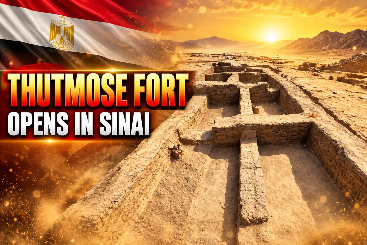
Egyptian archaeologists have opened an 8,000-square-metre New Kingdom fortress at Tell El-Kharouba on the Ways of Horus in North Sinai. A jar handle stamped with King Thutmose I came out of foundation deposits under a tower.
The Ministry of Tourism and Antiquities announced one of the largest Horus Road forts on October 11, 2025. The enclosure sits at Sheikh Zuweid, near the Mediterranean coast, on the old military road that tied the eastern Delta to Canaan.
Sand Gave Up a 105-Metre Southern Wall
The Egyptian mission, working for the Supreme Council of Antiquities, stripped dunes off a southern curtain wall about 105 metres long and 2.5 metres thick. A side gate 2.20 metres wide opens in the middle of that stretch.
Mohamed Ismail Khaled, secretary-general of the council, said the team also reached the north-western tower and parts of the northern and western walls. Shifting sand had buried those runs, and it still covers more of the plan.
Sherif Fathy, the tourism and antiquities minister, called the work a physical record of how New Kingdom builders set an eastern defence line to hold the land and the roads into Palestine. He said it also backs Sinai’s place as ground that keeps yielding civilizational evidence, a claim that now sits beside new building and security work in Sinai.
Eleven Towers and a Zigzag Built Against Wind
So far the mission has recorded 11 defensive towers. Mohamed Abdel-Badie, head of the Egyptian Antiquities Sector, said a 75-metre zigzag wall on the western side cuts the fort from north to south and wraps a residential quarter for soldiers.
Hesham Hussein, who led the excavation and heads the Central Administration for Lower Egypt Antiquities, said that broken line was not a flourish. It stiffened the wall and cut the bite of wind and sand. The same layout, he said, is a New Kingdom answer to desert ground.
THE FORTRESS AS CLEARED
| Feature | Figure |
|---|---|
| Area | 8,000 square metres (about 86,000 square feet) |
| Southern wall | 105 metres long, 2.5 metres thick |
| Side gate | 2.20 metres wide |
| Towers found so far | 11 |
| Zigzag inner wall | 75 metres, north to south |
| Older fort on the same tell | 700 metres southwest, one-third the area |
Hussein’s team has not published a full headcount from beds or ration lists. He gave a working range from the space that is already open.
Taking into account storerooms, courtyards, and other facilities, we estimate that the garrison likely ranged between 400 and 700 soldiers, with a reasonable average of around 500 soldiers.
Hesham Hussein, excavation leader, Egyptian Ministry of Tourism and Antiquities
That is an estimate for a post that still has walls under the dunes. It is enough to show a standing unit, not a watch hut.
A Jar Handle Ties the Fort to Thutmose I
Under one tower the diggers found foundation deposits from the first half of the 18th Dynasty. Among the pottery was a vessel handle sealed with the name of Thutmose I, who ruled from 1506-1493 B.C. on the low chronology used for his reign.
Those buried offerings are how Egyptian builders marked a new wall for the king. They put the fort in the early New Kingdom (1550-1070 B.C.), when Egypt was pushing hard into the Levant after driving out the Hyksos.
Thutmose I pushed Egyptian arms into Nubia and Syria, reaching toward the Euphrates on the northern march. A supply fort on the coastal Sinai road fits that program. Preliminary study already shows later crews patched the place and rebuilt the southern entrance more than once, so the post did not freeze in his reign.
What the Oven and Petrified Dough Show
The garrison baked on site. A large bread oven stood in the soldiers’ quarter, and fossilized dough still lay beside it, a batch that never went into the fire. Small ovens in outer recesses look like everyday hearths, Hussein said, used for daily domestic work inside the fortress rather than for a single field kitchen.
Pottery came out in shards and in whole vessels. The other surprise was volcanic stone the mission says was likely shipped from the volcanoes of the Greek islands. That cargo points to a coastal supply run, which is why the team said it hoped to find the military harbour that served the fort.
WHAT CAME OUT OF THE SAND
- The stamp: A jar handle sealed with the name of Thutmose I, from deposits under a tower.
- The kitchen: A large bread oven plus smaller recess hearths, with fossilized dough beside one oven.
- The stone: Volcanic pieces likely brought by sea from Greek islands, a hint of long-range supply.
- The pottery: Mixed sherds and intact vessels, including 18th Dynasty foundation deposits.
None of those objects needs a battle scene to matter. They show a post that fed men, stored goods, and took deliveries off the water.
Tell Heboua, Tell el-Borg, and This New Fort
Khaled said each new enclosure is another block in the map of Egypt’s eastern network in the New Kingdom. Tell El-Kharouba does not stand alone. The ministry placed it with Tell Heboua, Tell el-Borg, and Tell el-Abyad, all New Kingdom stations on the same road.
Tell Heboua, on the east bank of the Suez Canal near Qantara, is the site now widely identified as Tjaru, the fortified gate where armies left Egypt. Tell el-Borg sits a short march along the old lagoon edge. Tell el-Abyad continues the line toward the Rafah end of the coast. Hussein has mapped a mud road between Sinai forts that once linked Heboua to Tell el-Borg, a made surface rather than a track in loose sand.
FORTS ON THE SAME ROAD
| Site | Role on the road | Date range in play |
|---|---|---|
| Tell Heboua | Identified as Tjaru, Egypt’s eastern gate | New Kingdom, with heavy Ramesside building |
| Tell el-Borg | Next station on the coastal line | New Kingdom land-and-water post |
| Tell el-Abyad | Further station toward the Levant | New Kingdom |
| Tell El-Kharouba | Large coastal fort at Sheikh Zuweid | 18th Dynasty stamp of Thutmose I, later repairs |
| 1980s fort on the same tell | Smaller enclosure, 700 metres southwest | New Kingdom |
The Karnak relief of a king’s return from the Shasu country already drew this road as a string of named forts and water points. The new plan at Sheikh Zuweid is field evidence for that picture, not a one-off ruin with a Bible caption.
Why the Exodus Route Avoids the Philistine Road
Exodus 13:17 says that when Pharaoh let the people go, God did not lead them on the road through the Philistine country, even though it was shorter, because they might face war and turn back. That shorter road is this coastal highway, the Ways of Horus, lined with Egyptian forts from the Delta gate to Canaan.
A post that could hold around 500 men, with towers, a side gate, and its own bakery, is what “war” on that road looked like in the early 18th Dynasty. Anyone moving a large group along the Mediterranean strip would have met garrison after garrison, each within supporting distance of the next. The biblical writer’s warning matches the military geography the dig is filling in.
It does not, by itself, date a march or name a pharaoh of the Exodus. It shows why that coast was the wrong way out if the goal was to avoid Egyptian troops. The desert road toward the Red Sea in the same passage is the long way around a frontier that was already wired for war.
The 1980s Fort Still Sits 700 Metres Southwest
The new enclosure is three times the size of a New Kingdom fort found on the same site in the 1980s, about 700 metres to the southwest. Older survey work at Haruba, the name used in late-1970s and early-1980s literature for this stretch, had already flagged a cluster of Egyptian military sites. Eliezer Oren’s 1987 survey of the Ways of Horus treated two of them as administrative centres and one as a fort. The ministry has not said whether the wall system opened in 2025 is one of those known plans or a further enclosure.
Hussein said the mission wants the rest of the walls and the buildings that belong with them. Near the coast, the same team said it expected to find the harbour that fed the garrison, the logical partner to volcanic stone from the Aegean. That port has not been announced.
WHAT WE KNOW
- The fabric: An 8,000-square-metre New Kingdom fort with 11 towers, a 105-metre southern wall, and a 75-metre zigzag has been cleared in part.
- The date stamp: A Thutmose I handle and early 18th Dynasty foundation deposits fix the first building phase.
- The neighbour: A fort one-third the size was excavated 700 metres southwest in the 1980s.
WHAT IS UNCONFIRMED
- The harbour: A military port is expected near the coast and has not been shown.
- The full plan: Northern and western walls remain partly under dunes, so the tower count can still rise.
- The headcount: The 400 to 700 range is a space estimate, not a roster from texts.
Sinai crews are still on that eastern line. On October 2, 2026, the ministry reported a separate season at Tell Abu Seifi, where Hussein’s office is reading Ptolemaic and Roman gates and a ditch that may mark an older fort. Tell El-Kharouba stays the New Kingdom file: a big coastal station, a king’s name in the foundations, and bread dough that never saw the oven. The peninsula’s deeper record includes 10,000-year-old rock art in Sinai, far older than these walls, on the same land Fathy keeps calling a store of evidence.
Frequently Asked Questions
What Is a Foundation Deposit in an Egyptian Fort?
Builders buried pottery and other offerings under new walls or towers when work began, a rite that dedicated the structure and, when a royal name is stamped on a vessel, dates that phase. At Tell El-Kharouba those deposits sit under a tower and belong to the first half of the 18th Dynasty, which is why the handle of Thutmose I is treated as a construction stamp rather than stray rubbish.
Who Was Thutmose I Beyond the Jar Handle?
He was the third king of the 18th Dynasty, a ruler who rebuilt parts of Karnak with pylons and obelisks and who is credited as the first king to cut a tomb in the Valley of the Kings. His Nubian and Syrian campaigns set the military pattern his heirs followed, which is the context for a large supply fort on the road to Canaan.
Where Did the Ways of Horus Begin and End?
The road ran from the eastern Nile Delta along the north Sinai coast toward Gaza and Rafah, starting in the New Kingdom at the Tjaru gate now identified with Tell Heboua. Egyptian control of the route is attested from the Old Kingdom through the Saite 26th Dynasty, so the New Kingdom forts sit on an older artery rather than on a path invented in the 18th Dynasty.
Had Archaeologists Already Worked Tell El-Kharouba?
Yes. A smaller New Kingdom fort was excavated about 700 metres southwest in the 1980s, and Oren’s North Sinai survey had already described a Haruba cluster of military and administrative sites. The 2025 enclosure is the larger plan on that tell; the published statements do not settle whether it is a newly recognized fourth structure or a wall system those earlier teams only sampled.

Ninja Theory Staff Face Redundancy After Two Xbox Sales Collapse

Amazon Sells the MacBook Air at Its Pre-Hike Price

U.S. Slows Jet Parts to Squeeze China’s Flying Fleets

PEGI Pulled the GTA 6 Age Rating After Cocaine Details

Northwestern’s Smaller Ryan Field Gave Penn State Nowhere to Hide

Aramco Crash Kills 14 Two Days After Oil Restart

Salah Captained Egypt to Their First World Cup Win

Apple Labor Day Deals Hide June’s Memory Price Hike

Palworld 1.0.4 Adds Palpedia Search After the 1.0 Launch

Zelda’s 40th Switch 2 Ships Without a Zelda Game
-
 BUSINESS3 months ago
Aramco Crash Kills 14 Two Days After Oil Restart
-
 NEWS4 months ago
Salah Captained Egypt to Their First World Cup Win
-
 NEWS1 month ago
Apple Labor Day Deals Hide June’s Memory Price Hike
-
 GAMING4 weeks ago
Palworld 1.0.4 Adds Palpedia Search After the 1.0 Launch
-
 GAMING4 weeks ago
Zelda’s 40th Switch 2 Ships Without a Zelda Game
-

 NEWS3 months ago
El Niño Puts Israel’s Needed Winter Rain on a Flood Clock
-

 BUSINESS8 months ago
Egypt Bets EGP 638 Billion Can Open Sinai to Investors
-

 ENTERTAINMENT4 weeks ago
King Charles Letter Keeps Harry and Meghan as Private Citizens